How a colonial mail route, a dozen state toll roads and six decades of fights, disasters and rebuilding became the 1,904-mile main street of the East Coast.
1,904.61miles, Miami to Houlton, Maine
15states, plus 0.13 miles of D.C.
1957the year it was numbered 95
2018the first year it ran unbroken
Timeline: 36 moments that shaped I-95
Drag the slider, tap a dot, use the arrow keys, or swipe through the photos.
1600s19561965197519851995200520152025Before the InterstatesBuilding I-95Fights, gaps & disastersI-95 today
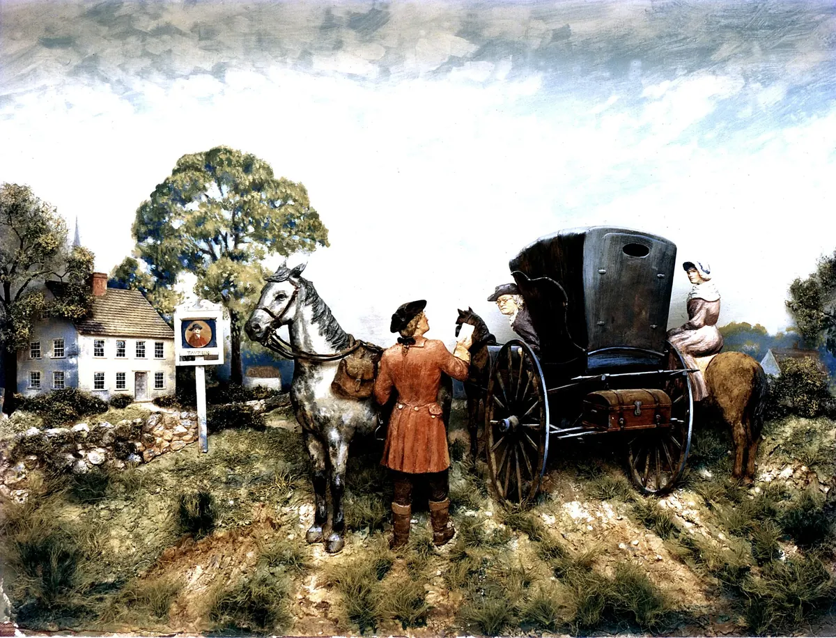
The first sections of the Boston Post Road were laid out in 1673, and the Federal Highway Administration calls it America's first mail route. A post rider covered the roughly 250 miles between New York and Boston in about two weeks.
Much of the Connecticut shoreline that I-95 follows today was first stitched together by this colonial road. In 1925 Massachusetts chose two of its branches to become US 1 and US 20.
Tichnor Brothers / Boston Public Library · Public domain
Nov. 11, 1926
Named trails become numbered highways, starting with US 1
Maine, Florida
A joint federal-state board replaced the patchwork of named auto trails, including the Atlantic Highway on the East Coast, with numbered routes. The first entry in its log was Route No. 1, from Fort Kent, Maine, to Miami.
State highway officials adopted the system on November 11, 1926. For the next 30 years, US 1 was the East Coast's main street.
Congress authorizes an Interstate network, without the money
President Franklin D. Roosevelt signed the Federal-Aid Highway Act of 1944. Section 7 authorized a National System of Interstate Highways of up to 40,000 miles but set aside no dedicated funds to build it.
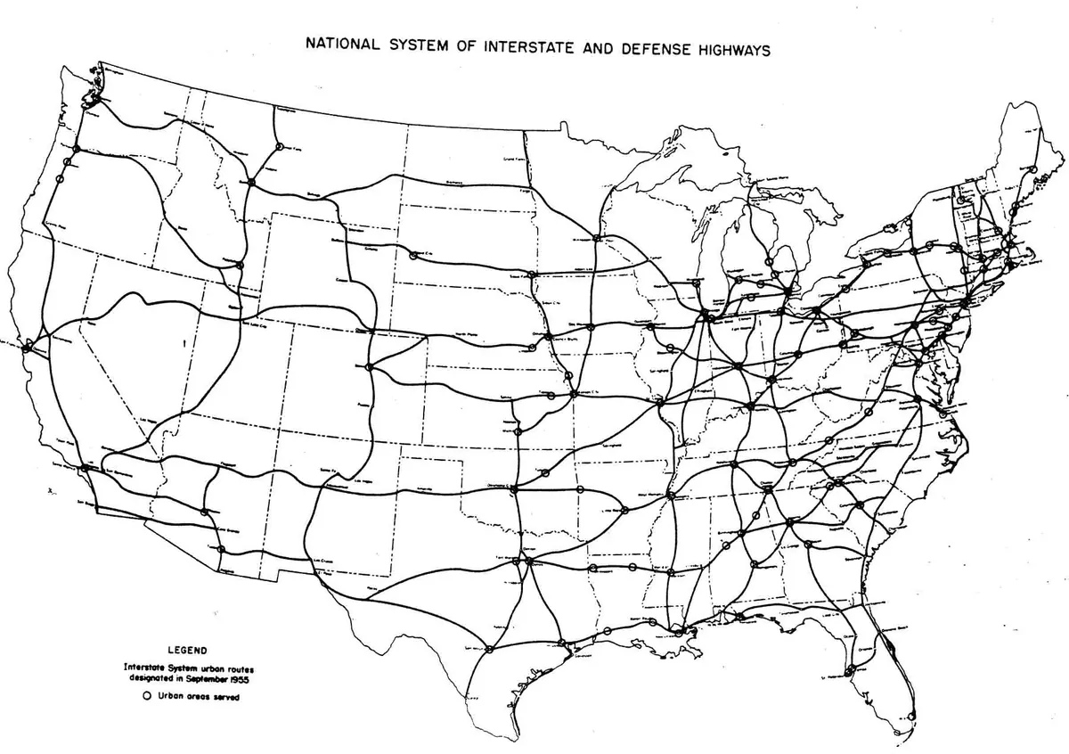
The first 37,700 Interstate miles are drawn on the map
Federal officials announced the first 37,700 miles of the system. Without construction money, progress stayed slow. States that wanted modern highways began building their own toll roads instead.
Tichnor Brothers / Boston Public Library · Public domain
Dec. 13, 1947
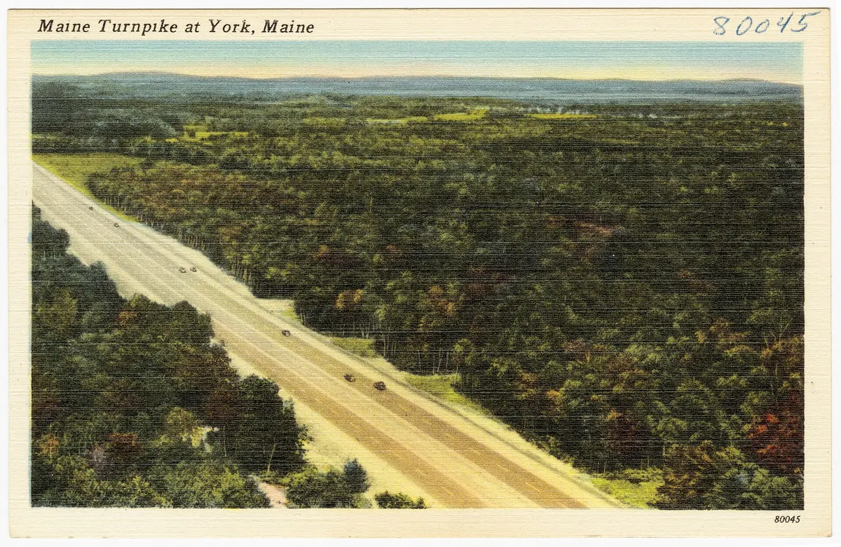
The Maine Turnpike opens
Maine
A 45-mile, four-lane toll road opened between Kittery and Portland, paid for with revenue bonds rather than tax money. Governor Edmund Muskie opened its extension to Augusta exactly eight years later.
The turnpike is now part of I-95, one of many pieces of the route that existed before the Interstate program did.
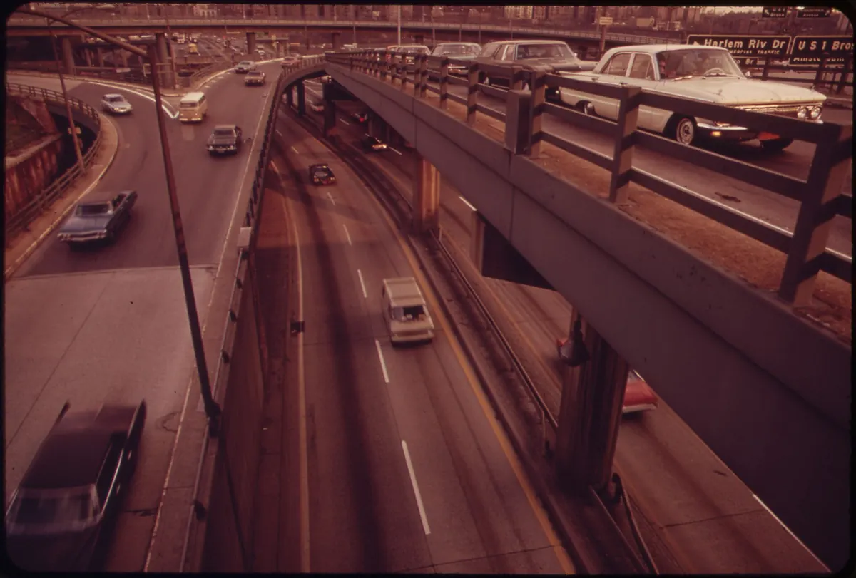
Construction began in 1948 on Robert Moses's expressway across the Bronx. It opened in stages, with the final link at the Alexander Hamilton Bridge in 1963.
New York City says the road cut through largely Black and Latino working-class neighborhoods and displaced about 40,000 residents; other estimates vary widely. Robert Caro's The Power Broker made its 'One Mile' through East Tremont a symbol of urban highway building.
The New Hampshire Turnpike, from the Massachusetts line at Seabrook to the Portsmouth traffic circle, was finished in 1950. It carried the I-95 designation by 1960 and was widened to eight lanes in the 1970s.
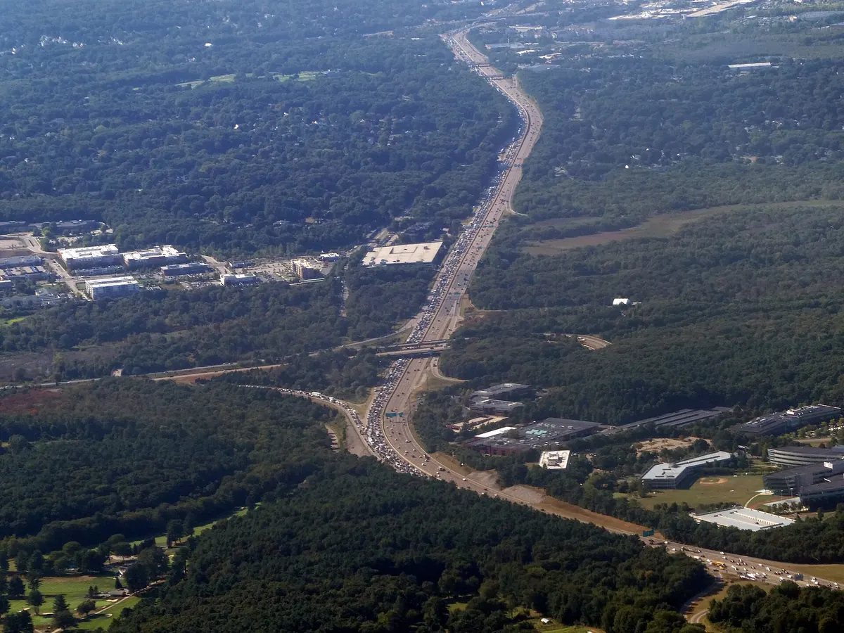
The first 22 miles of Massachusetts Route 128, from Wellesley to Lynnfield, opened in 1951. By 1956 it ran 65 miles from Gloucester to Braintree and was becoming the address of the research and electronics firms behind Boston's high-tech economy.
After Boston cancelled the expressway meant to carry I-95 through the city, the Interstate was moved onto about 37 miles of Route 128 instead.
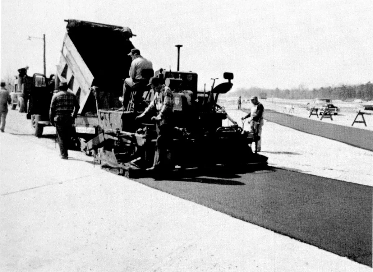
The New Jersey Turnpike Authority says its road was the third turnpike in the nation when it opened in 1951, running 118 miles. Accounts differ on whether the first section opened on November 5 or November 30.
Its central section now carries I-95, which is why New Jersey drivers on I-95 still pay tolls.
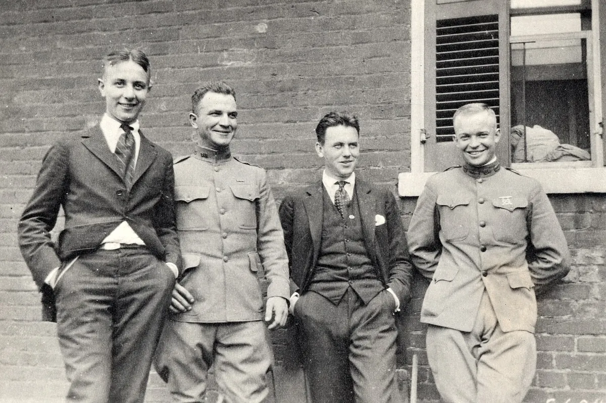
President Dwight D. Eisenhower signed the Federal-Aid Highway Act of 1956. It expanded the planned system to 41,000 miles, had Washington pay 90 percent of construction costs, and created the Highway Trust Fund, fed by fuel taxes, to pay for it.
The National Archives connects Eisenhower's support to the Army's slow 1919 cross-country convoy, which he joined, and to the German autobahns he saw in World War II.
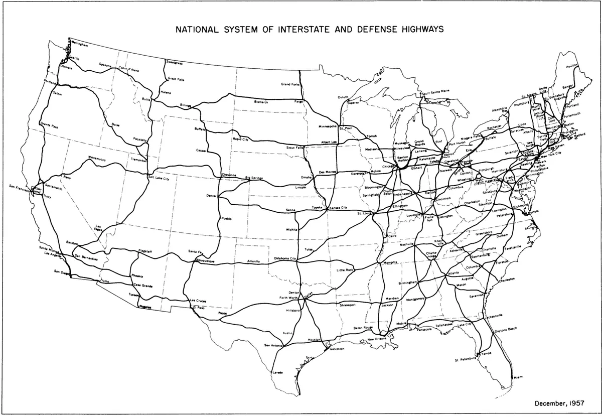
State highway officials adopted the red, white and blue Interstate shield and a numbering grid that mirrors the US routes, flipped so low numbers start in the west and south. Federal approval followed on September 10.
In the FHWA's words, the lowest number, I-5, went in the west and 'the highest, I-95, in the east.'
Governor Abraham Ribicoff opened the 129-mile toll road from Greenwich to Killingly. Its last three miles, including the bridges over the Mianus and Byram rivers, opened about ten months later and tied it to New York's New England Thruway.
Virginia's toll road between its capital and Petersburg opened in 1958 and now forms about 30 miles of I-95. Tolls were meant to end in 1986 but were extended, and the last one was collected in the summer of 1992.
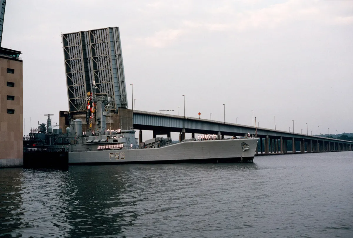
The six-lane drawbridge opened on what would have been President Wilson's 105th birthday. It was designed for about 75,000 vehicles a day and was carrying roughly 160,000 by the time it was replaced.
Part of the bridge lies inside Washington, D.C., which is how I-95 passes through the District for about 0.13 miles.
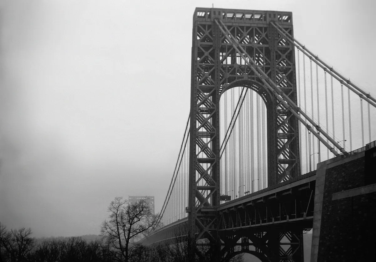
The 1931 bridge over the Hudson added a lower level in 1962. With the new Trans-Manhattan Expressway and Alexander Hamilton Bridge, it joined the Cross Bronx Expressway as part of I-95.
The Port Authority calls it the world's busiest bridge. About 102 million vehicles crossed it in 2010.
President Kennedy dedicates I-95 at the Maryland–Delaware line
Maryland, Delaware
With Governors J. Millard Tawes of Maryland and Elbert Carvel of Delaware, President John F. Kennedy dedicated the 59-mile Northeastern Expressway and Delaware Turnpike between Baltimore and Wilmington.
Eight days later he was assassinated in Dallas. In December 1963 Delaware asked that the road be named the John F. Kennedy Memorial Highway, the name it carries today.
Plans called for I-95 to cut through the District on the North Central Freeway. A coalition called the Emergency Committee on the Transportation Crisis fought it, and federal court rulings in 1968 and 1970 stalled the city's freeways.
By 1977 the unbuilt Interstates inside D.C. had been dropped. I-95 was routed around the city on the eastern Capital Beltway, and the old I-95 in Virginia became I-395.
Governor Francis Sargent ordered a moratorium on expressway building inside Route 128 in early 1970, then cancelled the Inner Belt and, on November 30, 1972, the I-95 Southwest Expressway that was to run into downtown Boston. 'We will not repeat history. We shall learn from it,' he said.
Land already cleared for the highway became the relocated Orange Line and the Southwest Corridor Park. I-95 went around Boston on Route 128.
Baltimore's 'Road Wars' push I-95 under the harbor
Maryland
For more than a decade the official plan sent I-95 across Baltimore's Inner Harbor near Federal Hill. Residents organized in 1967 to save Federal Hill and Fells Point, and in 1971 the General Assembly asked for a route that would not jeopardize Fort McHenry.
On January 23, 1975, the City Council voted 12–5 for a tunnel under the harbor instead.
New Jersey's Somerset Freeway is cancelled, leaving a gap
New Jersey, Pennsylvania
I-95 was supposed to cross central New Jersey through Hopewell, Princeton and Montgomery townships. After years of local opposition the Somerset Freeway was dropped. That left a hole in the middle of America's East Coast Interstate.
The 1982 Surface Transportation Assistance Act called for closing the gap with an interchange between I-95 and the Pennsylvania Turnpike. It took 36 years.
A tractor-trailer slammed into cars waiting at the Connecticut Turnpike toll plaza in Stratford, and the fire that followed killed seven people. Early reports blamed the truck's brakes; police later found no brake failure.
The crash is widely credited with ending tolls on Connecticut's I-95, which stopped in 1985.
At about 1:30 a.m. a 100-foot section of I-95's eastbound lanes in Greenwich fell 70 feet into the Mianus River. Two tractor-trailers and two cars went into the gap. Three people died and three were seriously injured.
The National Transportation Safety Board found that corrosion had pushed the hangers of a pin-and-hanger joint out of place without anyone noticing, and blamed shortcomings in Connecticut's bridge inspection and maintenance.
Work on I-95 through Philadelphia began in 1959, and the first section opened in 1964. The riverfront stretch was built through the 1970s, and a final piece near the airport was finished in 1985.
Society Hill residents won a sunken, partly covered design, while plans in Southwark called for tearing down about 2,000 rowhouses.
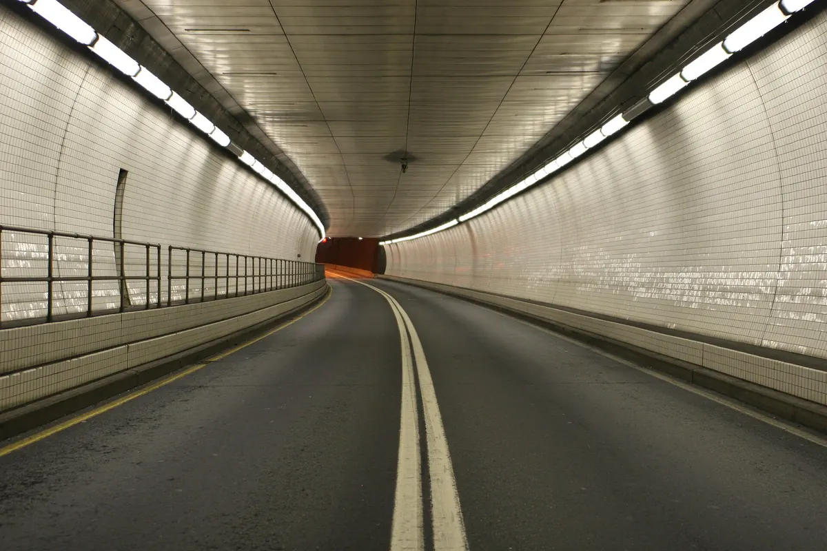
The eight-lane tunnel under Baltimore's harbor opened in the early morning hours as the final link of I-95 in Maryland. The Maryland Transportation Authority calls it the largest underwater highway tunnel, and the widest immersed-tube vehicle tunnel, when it was built.
It came in under its proposed $825 million budget.
Thirty miles of I-95 opened between Palm Beach Gardens and Stuart, completing the route in Florida after years of opposition in Martin County. Until then, through traffic between West Palm Beach and Fort Pierce used Florida's Turnpike.
Floyd's rains swamped eastern North Carolina. NOAA's Weather Prediction Center notes that sections of I-95 between Petersburg, Virginia, and Rocky Mount, North Carolina, were closed for days by flooding.
A tanker carrying about 12,000 gallons of fuel oil caught fire under the I-95 overpass in Bridgeport, and the southbound deck sagged three to four feet. The stretch carried nearly 120,000 vehicles a day. No one died.
Northbound lanes reopened that Sunday, and southbound traffic returned on a temporary bridge the following Wednesday.
A new Woodrow Wilson Bridge replaces the old drawbridge
Virginia, DC, Maryland
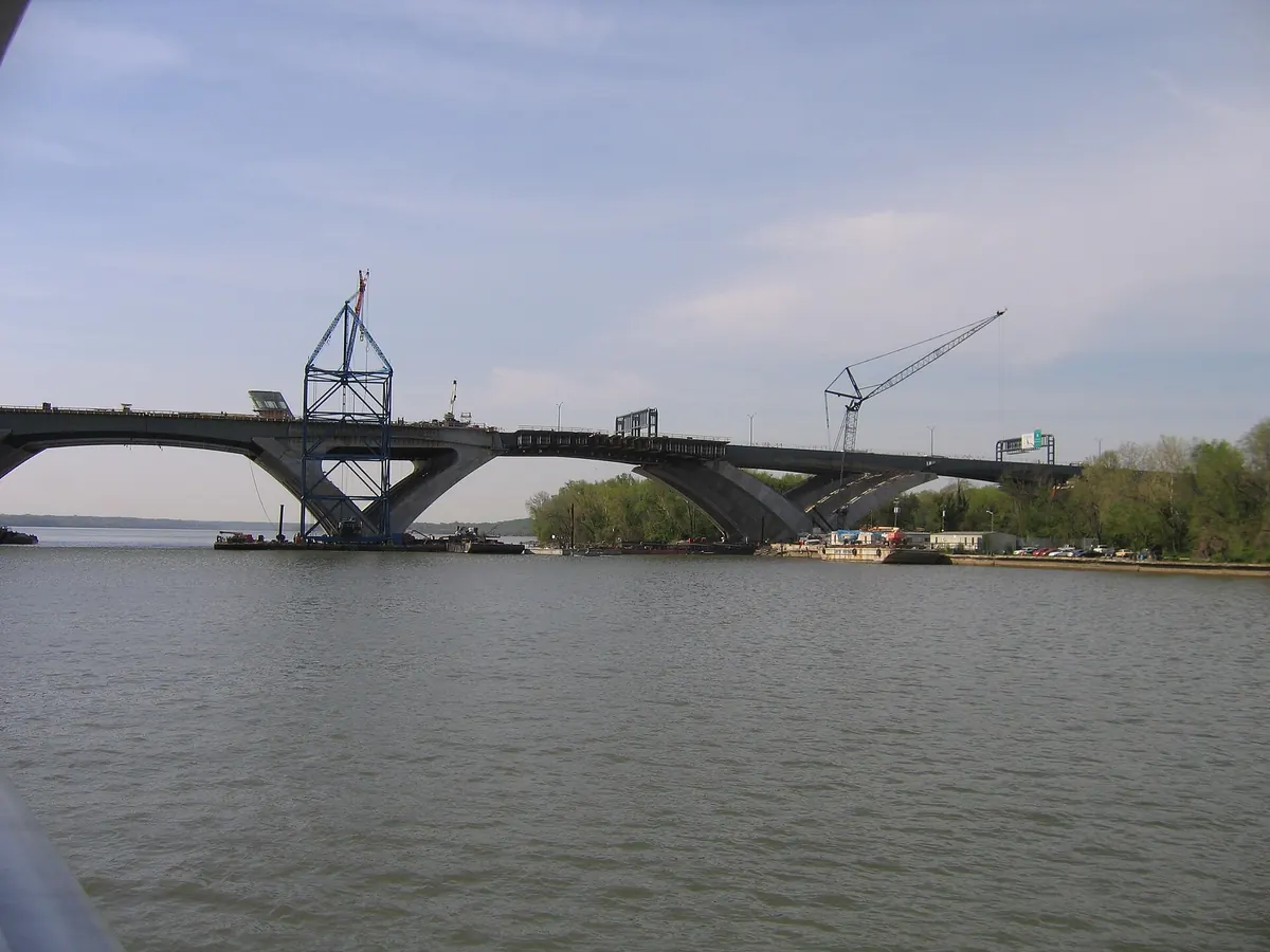
Traffic moved onto the first span of the replacement bridge in July 2006, and the last driver crossed the old bridge on July 15. The second span followed in 2008.
Virginia marked the end of an eight-year, $676 million rebuild of the Springfield Interchange, where I-95, I-395 and the Capital Beltway meet. Then-Governor Tim Kaine said the interchange carried well over 400,000 vehicles a day.
A federal audit had earlier found the project's costs up 180 percent since 1994.
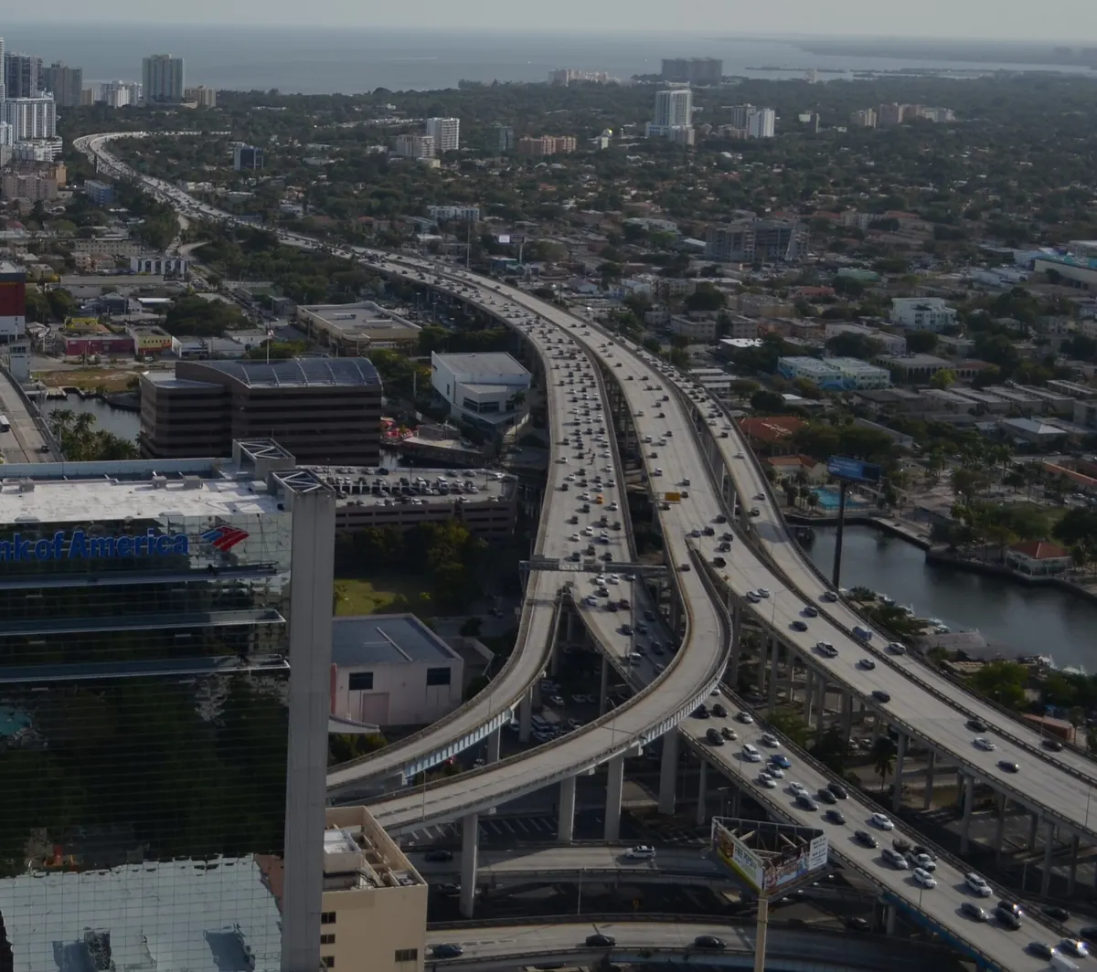
Miami converted I-95's HOV lanes into express lanes with tolls that rise and fall with traffic. Northbound lanes opened in December 2008 and southbound in January 2010.
Northern Virginia followed in December 2014 with its own 29-mile 95 Express Lanes, built under a 76-year public-private agreement.
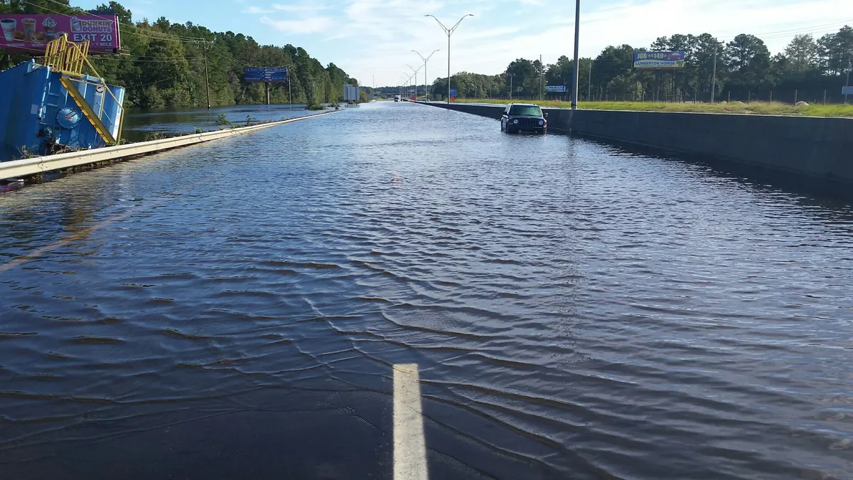
Flooding closed I-95 in North Carolina from Exit 13 at Lumberton to Exit 73 at Dunn, and a dam breach flooded the US 301 detour. Sections reopened over the following week.
Floodwaters from the Lumber River closed I-95 near Lumberton again. Officials warned it could stay closed until the end of the month, but the North Carolina Department of Transportation reopened all lanes on the evening of September 23.
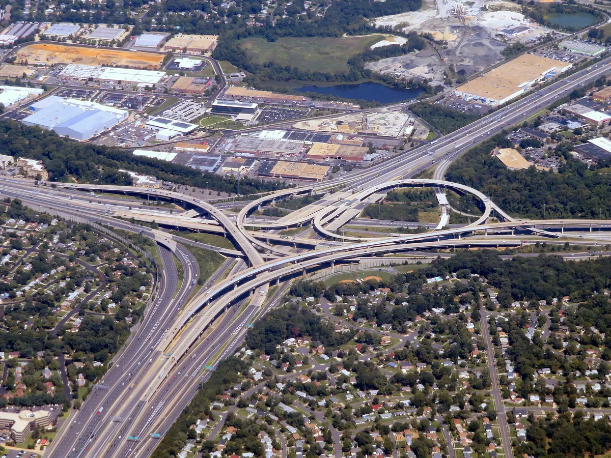
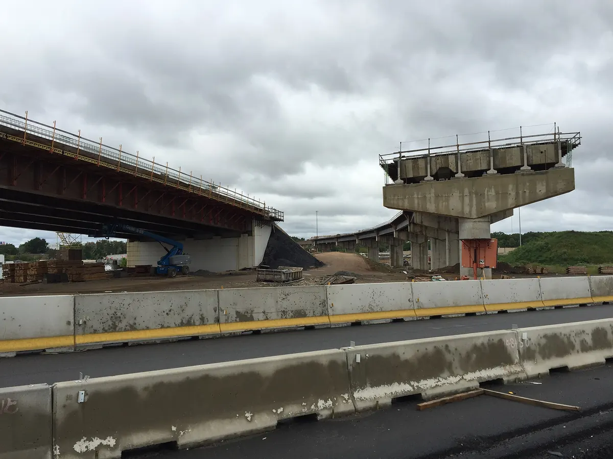
New flyover ramps linking I-95 and the Pennsylvania Turnpike opened in Bristol Township, Pennsylvania. I-95 was rerouted over the Turnpike's Delaware River bridge to the New Jersey Turnpike, and the old Trenton-area I-95 became I-295.
The first stage cost $425 million. For the first time, the 1950s plan for one continuous East Coast Interstate was complete.
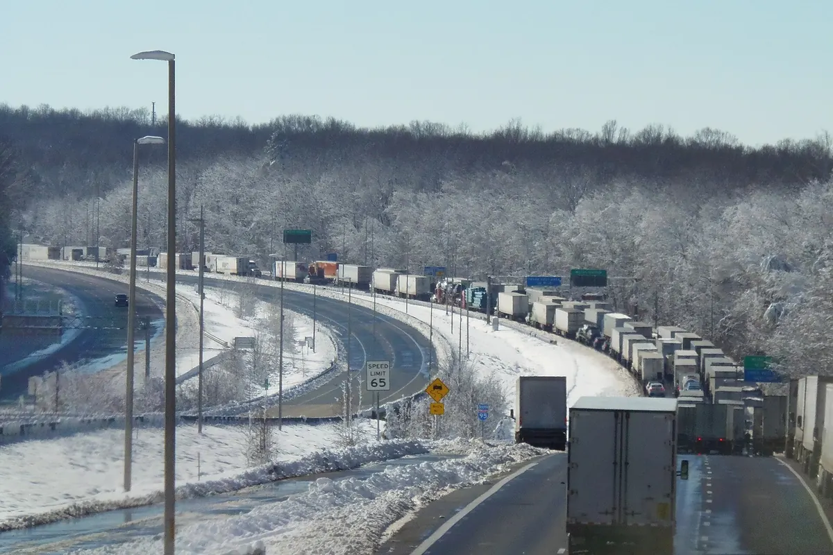
Heavy snow on untreated pavement and jackknifed trucks froze I-95 near Fredericksburg for roughly 40 to 50 miles. Drivers were stranded overnight; Senator Tim Kaine spent about 27 hours on a trip that normally takes two.
The road reopened that evening. An after-action report found up to 14.6 inches of snow and traffic nearly 65 percent above 2019 levels, and the state inspector general found lessons from a 2018 I-81 shutdown had not been applied.
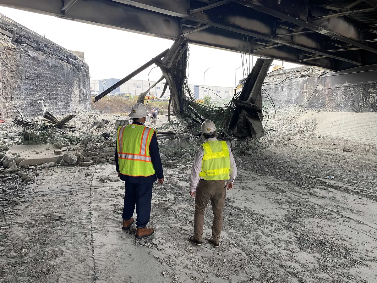
A gasoline tanker crashed on the Cottman Avenue off-ramp in Northeast Philadelphia and burst into flames, bringing down the northbound span and killing the driver. About 160,000 vehicles used that stretch every day.
Crews built a temporary six-lane roadway on lightweight glass aggregate fill and reopened I-95 in 12 days. The NTSB later cited the driver's failure to slow on a ramp with a 25-mph advisory speed.
A car merging onto I-95 South hit a petroleum tanker, which crashed and burned under the Fairfield Avenue overpass. No one was hurt, but the bridge was ruined.
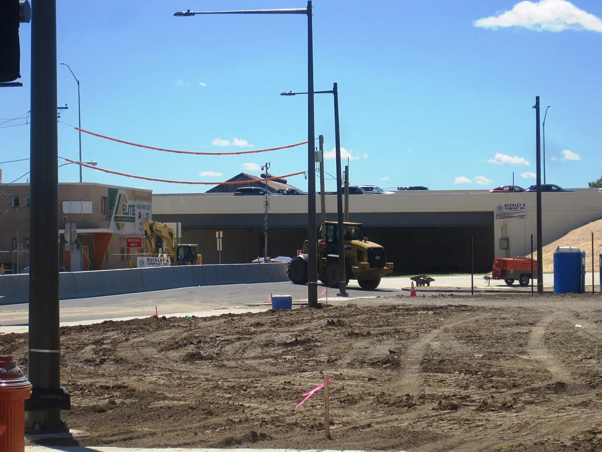
Crews tore down the overpass in less than 36 hours, and I-95 fully reopened on May 5, less than 80 hours after the crash.
Interstate 95 runs 1,904.61 miles from US 1 just south of downtown Miami to the Canadian border at Houlton, Maine,
where it continues into New Brunswick as Route 95.[1] It passes through 15 states, more than any other Interstate,
and for about 0.13 miles through Washington, D.C., on the Woodrow Wilson Bridge.[1] It is the longest
north–south Interstate in the country and the sixth-longest Interstate overall.[1]
Its number is no accident. Under the grid adopted in 1957, north–south Interstates get odd numbers that rise from
west to east, so the lowest, I-5, runs along the Pacific and the highest, I-95, along the Atlantic.[2, 8]
The corridor it serves is the most crowded in the country. In 2007 the I-95 Corridor Coalition estimated that the
15 states along it held about 40 percent of U.S. economic output, with a population density more than three times the
national average.[3] Its single busiest crossing, the George Washington Bridge, is described by the Port Authority as
the world's busiest bridge; about 102 million vehicles crossed it in 2010.[32]
From colonial post road to US 1
Long before there was an Interstate, the Northeast's coast was tied together by the Boston Post Road. Its first
sections were laid out in 1673, and the Federal Highway Administration calls it America's first mail route; a rider made
the 250-mile trip between New York and Boston in about two weeks.[4] The road carried the first long-distance
stagecoach service in 1783.[4]
In the age of the automobile, the East Coast was crossed by named trails such as the Atlantic Highway. In 1925 and 1926
a joint federal and state board replaced the names with numbers, and the first route in its log was Route No. 1, from
Fort Kent, Maine, to Miami.[5]
Congress authorized a national network of limited-access "Interstate" highways in 1944, and federal officials drew
the first 37,700 miles on the map in 1947, but neither step came with dedicated money to build them.[6] That changed
on June 29, 1956, when President Eisenhower signed the Federal-Aid Highway Act, which paid 90 percent of construction
costs through a new Highway Trust Fund.[7] A year later the East Coast route was given its number:
95.[8]See 1956 on the timeline.
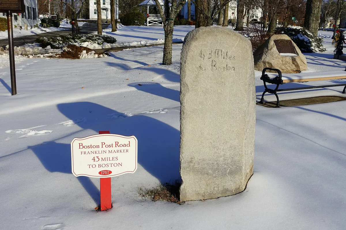
A colonial Boston Post Road milestone in Shrewsbury, Massachusetts. Photo: Daderot · Public domain
The toll roads that came first
In much of the Northeast, I-95 was not built so much as assembled. Tired of waiting for federal money, states built
their own superhighways in the late 1940s and 1950s and paid for them with tolls:
The Maine Turnpike opened between Kittery and Portland in December 1947, financed by revenue bonds.[9]
The New Jersey Turnpike opened in 1951, the third turnpike in the nation.[10]
The Connecticut Turnpike opened from Greenwich to Killingly on January 2, 1958.[11]
Virginia's Richmond–Petersburg Turnpike opened in 1958.[12]
When the Interstate system arrived, these roads were folded into it. The Maine Turnpike Authority notes that the 1956
act made further extensions of its own road unnecessary.[9] The inheritance is still visible: drivers on I-95 pay
tolls in Maine, New Hampshire, New Jersey, Delaware and Maryland, while Connecticut ended its tolls in 1985, two years
after seven people died in a fiery crash at the Stratford toll plaza,[11] and Virginia collected its last
Richmond–Petersburg toll in 1992.[12]
Some of the new road was dedicated with ceremony. On November 14, 1963, President John F. Kennedy dedicated the
59-mile stretch between Baltimore and Wilmington at the Maryland–Delaware line. He was assassinated eight days later,
and the road now carries his name.[13]See 1963 on the timeline.
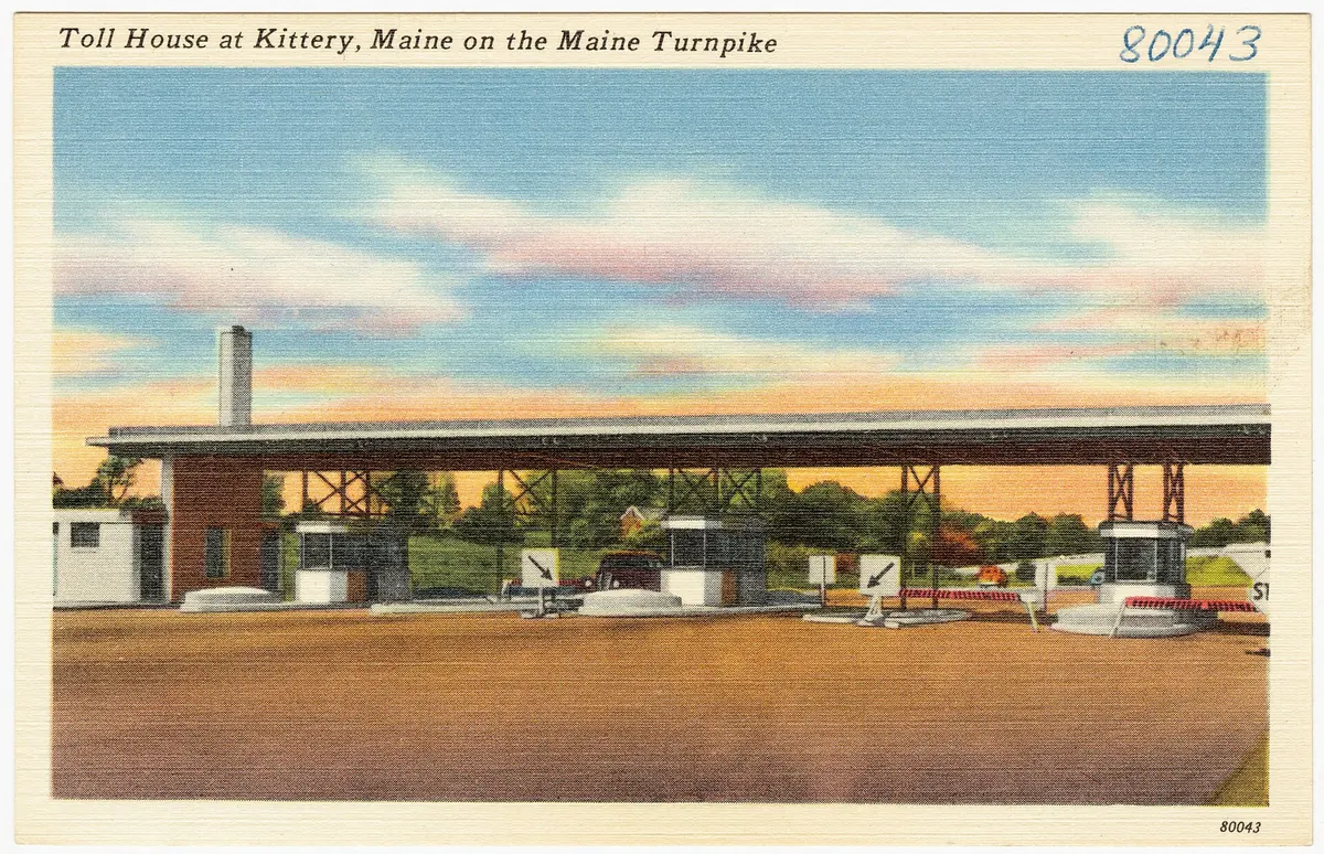
The Maine Turnpike's original toll house at Kittery, on a postcard from the turnpike's early years. Tichnor Brothers / Boston Public Library · Public domain
The cities fight back
In cities, I-95's path ran through established neighborhoods, and some of the best-known highway revolts in
American history were fought over it.
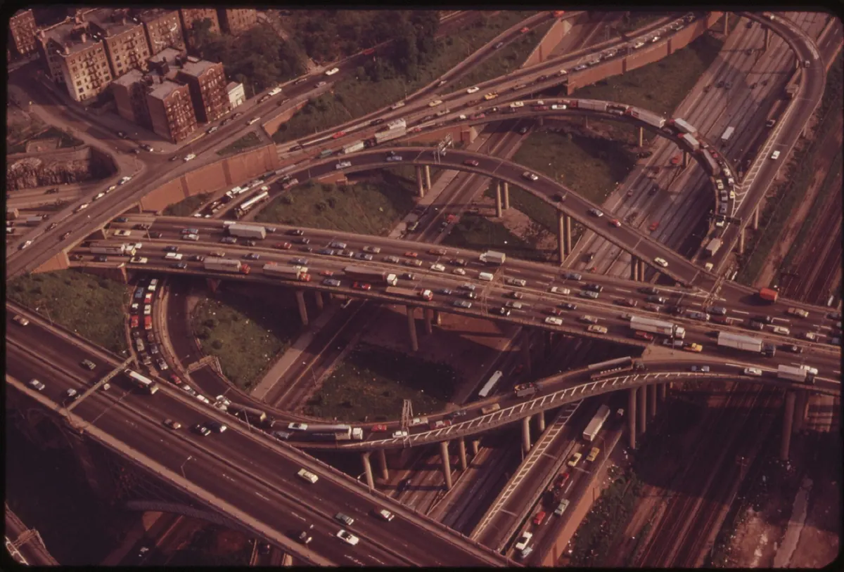
New York. Robert Moses's Cross Bronx Expressway, begun in 1948 and finished in 1963, is the classic
case. New York City says it cut through largely Black and Latino working-class neighborhoods and displaced about
40,000 residents; in 2022 the city and state began studying how to cap parts of it.[14]
Philadelphia. Society Hill residents won a sunken, partly covered highway along the Delaware River,
while plans in Southwark called for demolishing about 2,000 rowhouses.[15]
Boston. I-95 was meant to run into downtown on the Southwest Expressway. Governor Francis Sargent
halted expressway building inside Route 128 in 1970 and cancelled the road in 1972. The land already cleared became
the relocated Orange Line and a linear park, and I-95 went around the city on Route 128 instead.[16, 17]
Washington. Citizen groups and federal court rulings stopped the freeways planned through the
District, and by 1977 I-95 was routed around the city on the Capital Beltway.[18]
Baltimore. Residents of Federal Hill and Fells Point fought plans to carry I-95 across the Inner
Harbor. The compromise was a tunnel: the Fort McHenry Tunnel, which opened in November 1985 as the final link of I-95
in Maryland.[19, 20]See 1975 on the timeline.
Cross Bronx Expressway interchange ramps near the George Washington Bridge, May 1973. Chester Higgins Jr. / U.S. National Archives · Public domain
Gaps, and finally a continuous road
Because I-95 was built in pieces, it was finished in pieces. Philadelphia completed its last segment, near the
airport, in 1985.[15] Florida opened its last 30 miles, between Palm Beach Gardens and Stuart, on
December 19, 1987; until then, through traffic used Florida's Turnpike.[21]
The last gap was in New Jersey. After the planned Somerset Freeway through Princeton-area townships was dropped,
the 1982 Surface Transportation Assistance Act called for completing I-95 with an interchange between it and the
Pennsylvania Turnpike.[22] That interchange opened on September 22, 2018, more than 60 years after the route was
numbered, and I-95 became continuous from Miami to Maine for the first time.[23]See 2018 on the timeline.
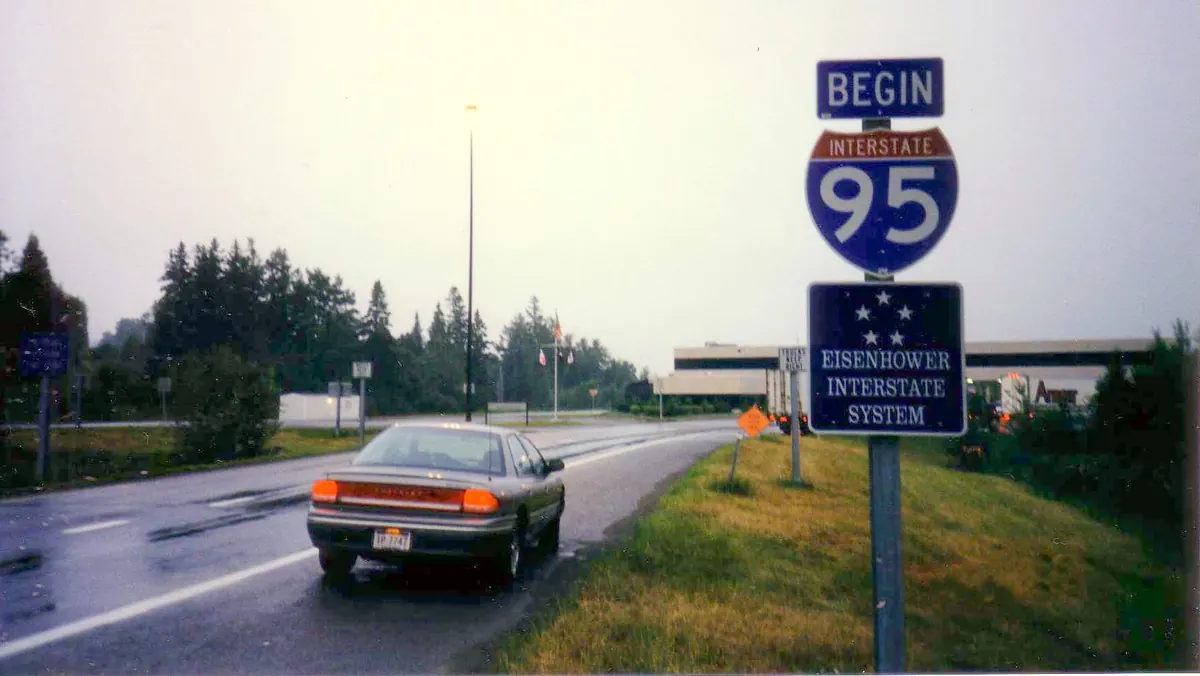
Where I-95 begins for southbound drivers: the Canadian border near Houlton, Maine. Photo: Christopher Ziemnowicz · Public domain
Disasters, and how fast I-95 comes back
On June 28, 1983, a 100-foot span of I-95 over the Mianus River in Greenwich, Connecticut, fell 70 feet into the
water, killing three people. The National Transportation Safety Board traced it to corroded hangers in a pin-and-hanger
joint and to shortcomings in the state's bridge inspection program.[24]See 1983 on the timeline.
Fuel tankers have proven to be one of the road's biggest threats. A tanker fire in Bridgeport in 2004 sagged the
deck of an overpass carrying nearly 120,000 vehicles a day.[25] In June 2023 a gasoline tanker crash in Northeast
Philadelphia collapsed the northbound span; crews reopened six lanes on a temporary roadway in 12 days.[26] In May 2024
a tanker fire in Norwalk, Connecticut, destroyed an overpass, and I-95 was fully reopened in less than 80 hours.[27]
Weather has closed long stretches too. Hurricane Floyd flooded I-95 between Petersburg, Virginia, and Rocky Mount,
North Carolina, for days in 1999,[28] and Hurricane Matthew closed 60 miles of it in North Carolina in
2016.[29] In January 2022, snow and jackknifed trucks stranded drivers overnight near Fredericksburg, Virginia; a
state audit found that lessons from an earlier interstate shutdown had not been applied.[30]
The rebuilt Cottman Avenue overpass in Philadelphia, a year after the 2023 collapse. Photo: Mr. Matté · CC BY-SA 4.0
How dangerous is I-95?
Insurance and marketing sites often call I-95 "America's deadliest highway." The government's own crash data paint a
more careful picture. We counted fatal crashes on I-95 in the National Highway Traffic Safety Administration's Fatality
Analysis Reporting System (FARS) for 2018 through 2024.[31]
Roughly 300 to 375 people died in crashes on I-95 each year, more than 2,300 over the seven years.
I-95 had the second-most deaths of any Interstate in most years, behind I-10, and the most in 2020.
Florida accounts for about 35 percent of I-95 deaths while holding about 20 percent of its
mileage.[1, 31]
Two cautions. I-95 is one of the most heavily traveled roads in the country, so a high count does not by itself mean
a high risk per mile driven. And FARS counts depend on how each state records the road a crash happened on; our counts
match crashes whose primary roadway is recorded as I-95 and may differ slightly from other analyses.
Today, express toll lanes manage congestion in Miami (since 2008) and Northern Virginia (since 2014),[34, 35] and
the Springfield Interchange outside Washington was rebuilt for $676 million; when it was finished in 2007, Virginia's
governor said it carried well over 400,000 vehicles a day.[33] You can follow crashes as they happen on our live I-95 crash map, or browse the last 30 days
by state, from Florida to Maine.
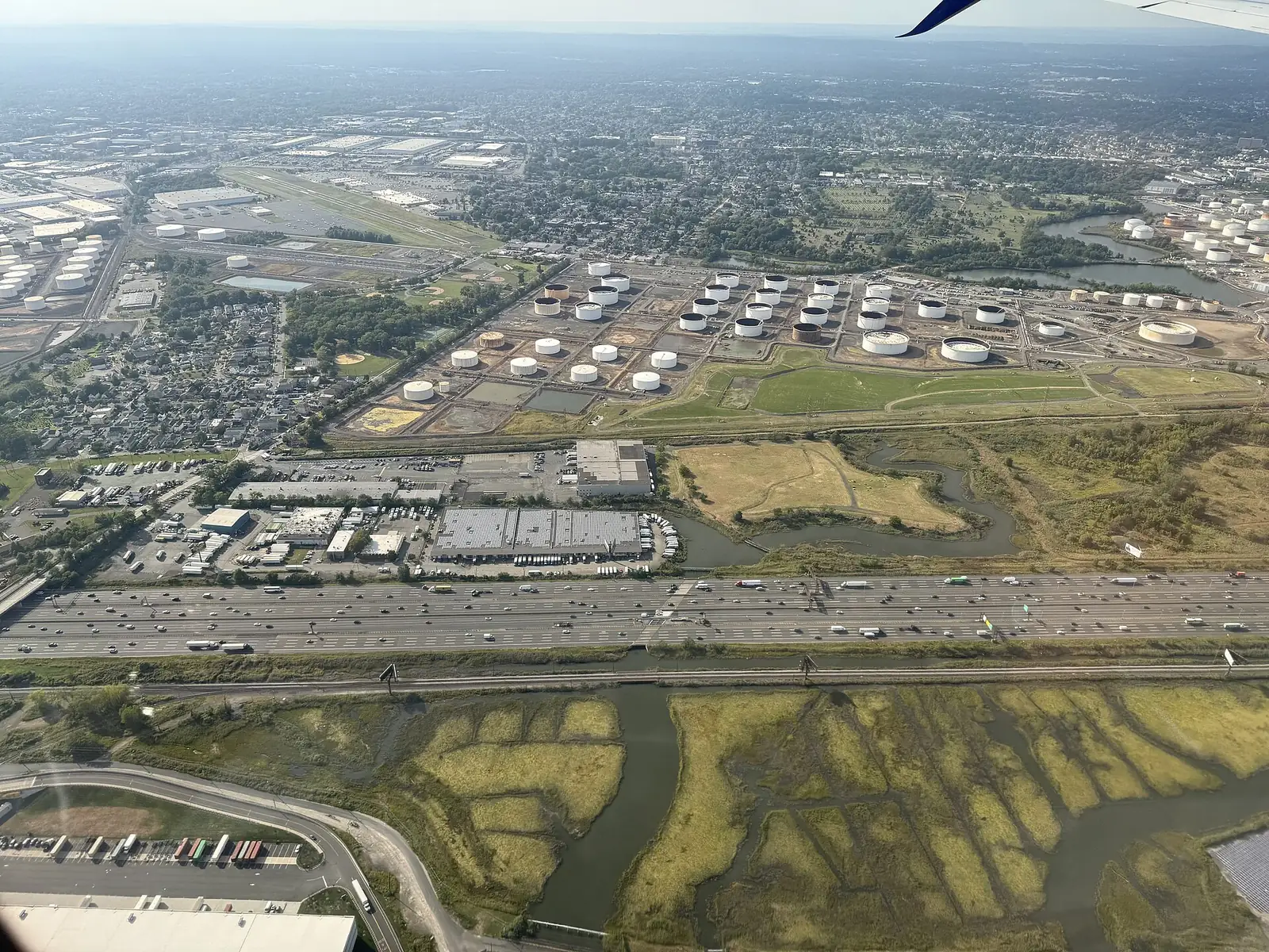
I-95 on the New Jersey Turnpike in Linden, New Jersey, seen from the air in 2025: Photo: Famartin · CC BY-SA 4.0
Federal Highway Administration illustration of travelers on the Boston Post Road in 1763: Federal Highway Administration · Public domain
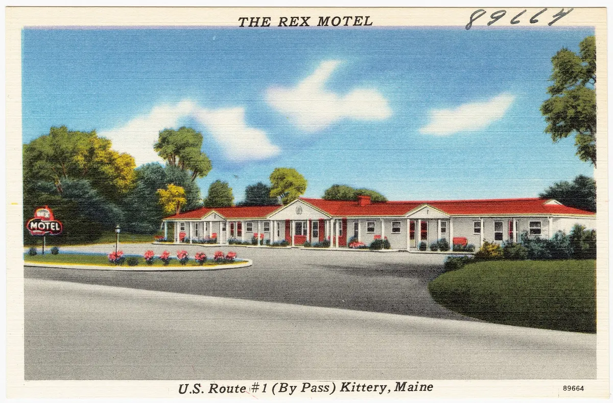
Linen postcard of a motel on the U.S. Route 1 bypass in Kittery, Maine, about 1930–1945: Tichnor Brothers / Boston Public Library · Public domain
The September 1955 “Yellow Book” map of the planned Interstate system: Bureau of Public Roads · Public domain
Linen postcard of the newly built Maine Turnpike at York, Maine, late 1940s: Tichnor Brothers / Boston Public Library · Public domain
Traffic on the sunken Cross Bronx Expressway in April 1973: Dan McCoy / U.S. National Archives · Public domain
Aerial view of the I-95 and I-93 junction in Canton, Massachusetts, where Route 128 begins: Photo: Pi.1415926535 · CC BY-SA 4.0
Crews paving the New Jersey Turnpike in the early 1950s: Federal Highway Administration · Public domain
Lt. Col. Dwight D. Eisenhower with fellow officers on the Army's 1919 transcontinental convoy: Unknown photographer · Public domain
Official December 1957 map of the National System of Interstate and Defense Highways: Bureau of Public Roads · Public domain
A British frigate passing through the raised draw span of the original Woodrow Wilson Bridge, 1985: Don S. Montgomery, U.S. Navy · Public domain
The George Washington Bridge in February 1965: Photo: Jim Evans · CC BY-SA 4.0
Boston's Southwest Corridor, built on land cleared for the cancelled I-95 expressway, in 2011: Photo: Pi.1415926535 · CC BY-SA 3.0
Inside the Fort McHenry Tunnel under Baltimore Harbor: Photo: Ewillison · CC BY-SA 4.0
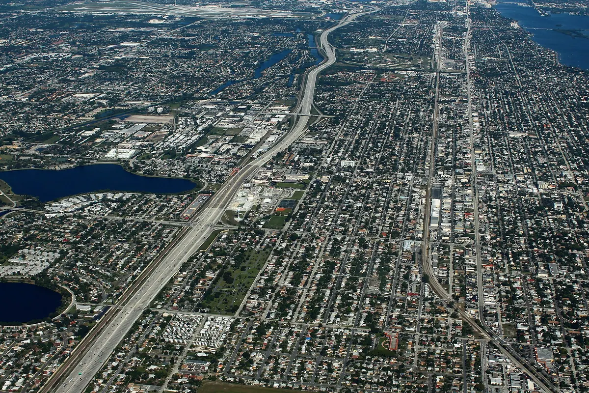
Aerial view of I-95 heading north through Lake Worth, Palm Beach County, Florida: Photo: formulanone · CC BY-SA 2.0
The replacement Woodrow Wilson Bridge under construction in April 2007: Photo: Andrew Bossi · CC BY-SA 2.5
Aerial view of the rebuilt Springfield Interchange in Virginia, 2018: Photo: Pi.1415926535 · CC BY-SA 3.0
Aerial view of northbound I-95 traffic in downtown Miami, 2013: Photo: B137 · CC0
I-95 under floodwater near Lumberton, North Carolina, after Hurricane Matthew, October 2016: NCDOT Communications · CC BY 2.0
Ramps of the I-95 / Pennsylvania Turnpike interchange under construction in Bristol Township, 2017: Photo: Famartin · CC BY-SA 4.0
Stopped traffic on I-95 in Prince William County, Virginia, during the January 2022 storm: Photo: Sblover99 · CC BY-SA 4.0
Federal Highway Administration officials inspecting the collapsed I-95 span in Philadelphia, June 12, 2023: Federal Highway Administration · Public domain
Colonial “43 Miles to Boston” Boston Post Road milestone in Shrewsbury, Massachusetts: Photo: Daderot · Public domain
Postcard of the original Maine Turnpike toll house at Kittery: Tichnor Brothers / Boston Public Library · Public domain
Aerial view of Cross Bronx Expressway interchange ramps, May 1973: Chester Higgins Jr. / U.S. National Archives · Public domain
“Begin Interstate 95” sign at the Canadian border near Houlton, Maine: Photo: Christopher Ziemnowicz · Public domain
The rebuilt I-95 overpass at Cottman Avenue, Philadelphia, June 2024: Photo: Mr. Matté · CC BY-SA 4.0
Last updated October 21, 2026. Spotted an error? Facts on this page are drawn from the sources above.